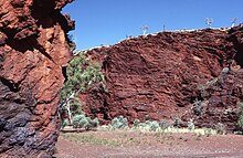
East Pilbara
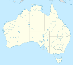
Rehiyon ang East Pilbara sa Ostralya.[1] Nahimutang ni sa estado sa State of Western Australia, sa kasadpang bahin sa nasod, 2,900 km sa amihanan-kasadpan sa Canberra ang ulohan sa nasod. Adunay 12,960 ka molupyo.[1]
| East Pilbara | |
| Rehiyon | |
| Nasod | |
|---|---|
| Estado | State of Western Australia |
| Gitas-on | 267 m (876 ft) |
| Tiganos | 21°36′48″S 123°42′49″E / 21.61331°S 123.71368°E |
| Population | 12,960 (2014-07-26) [1] |
| Timezone | AWST (UTC+8) |
| GeoNames | 7839505 |
Mga lungsod sa East Pilbara:
Sa mosunod nga mga natural nga mga bahin makita sa East Pilbara:
- Mga suba:
- Mga bungtod:
- Anketell Hills (bungtod)
- Barbilgunyah (bungtod)
- Baroona Hill (bungtod)
- Battle Hill (bungtod)
- Bee Hill (bungtod)
- Bibi Thaloo Hill (bungtod)
- Black Hill (bungtod)
- Bocrabee Hill (bungtod)
- Brownrigg Hill (bungtod)
- Brunette Hill (bungtod)
- Buck Hills (bungtod)
- Bullgarina Hill (bungtod)
- Cairn Barru-gu-ru (bungtod)
- Cairn Hill (bungtod)
- Camel Hill (bungtod)
- Camel Hill (bungtod)
- Cape Warton (bungtod)
- Carlindie Hill (bungtod)
- Cave Hill (bungtod)
- Chielagunja (bungtod)
- Chimingadgi Hill (bungtod)
- Chocolate Hill (bungtod)
- Citadell Hill (bungtod)
- Compton Pinnacle (bungtod)
- Contention Heights (bungtod)
- Cooke Bluff Hill (bungtod)
- Coondewanna (bungtod)
- Coondewanna Hill (bungtod)
- Cronin Hills (bungtod)
- Cuncudgerie Hill (bungtod)
- Cuncudgerie Hill (bungtod)
- Dakota Hills (bungtod)
- Eidibee Hill (bungtod)
- Eileen Hill (bungtod)
- Elizabeth Hills (bungtod)
- Feys Hill (bungtod)
- Five Mile Hill (bungtod)
- Ghost Castle (bungtod)
- Giles Point (bungtod)
- Gordon Hills (bungtod)
- Gossan Hill (bungtod)
- Hallcomes Peak (bungtod)
- Helen Hill (bungtod)
- Helen Hill (bungtod)
- Hill Y (bungtod)
- Hill Z (bungtod)
- Iron Hill (bungtod)
- Ironstone Hill (bungtod)
- Island Hill (bungtod)
- Kaliranu Hill (bungtod)
- King Hill (bungtod)
- King Hill (bungtod)
- Koongalin Hill (bungtod)
- Kunningina Hill (bungtod)
- Kurili Hill (bungtod)
- Low Quartz Hill (bungtod)
- Mccamets Monster (bungtod)
- McPhee Hill (bungtod)
- Merrimerica Hill (bungtod)
- Miles Hill (bungtod)
- Minyari Hill (bungtod)
- Moses Chair (bungtod)
- Mount Cecelia (bungtod)
- Mount Cecilia (bungtod)
- Mount Connaughton (bungtod)
- Mount Cotton (bungtod)
- Mount Crofton (bungtod)
- Mount Elsie (bungtod)
- Mount Macpherson (bungtod)
- Mount McKay (bungtod)
- Mount McLarty (bungtod)
- Mount Morris (bungtod)
- Mount Robinson (bungtod)
- Mount Rosamund (bungtod)
- Mount Shoesmith (bungtod)
- Mount Webb (bungtod)
- Mulgandinnah Hill (bungtod)
- Mulgundoona Hill (bungtod)
- Muttarbarty Hill (bungtod)
- North Dromedary (bungtod)
- Packsaddle Hill (bungtod)
- Padtherung (bungtod)
- Padtherung Hill (bungtod)
- Pamelia Hill (bungtod)
- Peelbegunja Hill (bungtod)
- Picture Hill (bungtod)
- Pincunah (bungtod)
- Point Moody (bungtod)
- Pulgorah Cone (bungtod)
- Puntapunta Hill (bungtod)
- Pyramid Hill (bungtod)
- Pyramid Hill (bungtod)
- Quartz Hill (bungtod)
- Rat Hill (bungtod)
- Red Hill (bungtod)
- Red Hill (bungtod)
- Ripon Hills (bungtod)
- Roy Hill (bungtod)
- Saddleback Hill (bungtod)
- Said Ameer Hill (bungtod)
- Shovelanna Hill (bungtod)
- Spear Hill (bungtod)
- Sugarloaf (bungtod)
- Sunday Hill (bungtod)
- Table Top Hill (bungtod)
- Talga Hill (bungtod)
- Tanguin Hill (bungtod)
- Telfer Dome (bungtod)
- The Dome (bungtod)
- The Governor (bungtod)
- The Governor (bungtod)
- The Island Hill (bungtod)
- The Pinnacles (bungtod)
- The Three Sisters (bungtod)
- Thompson Hills (bungtod)
- Three Sister Hills (bungtod)
- Thursday Hill (bungtod)
- Tom Tit Hill (bungtod)
- Top Up Rise (bungtod)
- Triwhite Hills (bungtod)
- Turkey Place Hill (bungtod)
- Twin Gum Hill (bungtod)
- Tyama Hill (bungtod)
- Ulalling Hills (bungtod)
- Warroo Hill (bungtod)
- Watch Point Hill (bungtod)
- West Angela Hill (bungtod)
- West Dome (bungtod)
- Wheelarra Hill (bungtod)
- White Quartz Hill (bungtod)
- White Quartz Hill (bungtod)
- White Quartz Knob (bungtod)
- Woblegun Hill (bungtod)
- Yarrana Heights (bungtod)
- Ylbalgul (bungtod)
- Mga lawis:
- Kabukiran:
- Ant Hill Peak (tumoy sa bukid)
- Bremner Peak (tumoy sa bukid)
- Camel Rock (bukid)
- Compton Pinnacle (bukid)
- Dooleena (bukid)
- Doolena Peak (tumoy sa bukid)
- Horrigan Peak (tumoy sa bukid)
- Jolly Peaks (tumoy sa bukid)
- Lynn Peak (tumoy sa bukid)
- Marble Bar (bukid)
- Minderungumya (bukid)
- Mount Cooke (bukid)
- Mount Crofton (bukid)
- Mount Divide (bukid)
- Mount Edgar (bukid)
- Mount Ella (bukid)
- Mount Ella/Gujuwanna (bukid)
- Mount Eva (bukid)
- Mount Frank (bukid)
- Mount Goldsworthy (bukid)
- Mount Grant (bukid)
- Mount Greene (bukid)
- Mount Hays (bukid)
- Mount Hilditch (bukid)
- Mount Hodgson (bukid)
- Mount Isdell (bukid)
- Mount Lewin (bukid)
- Mount Maggie (bukid)
- Mount Marsh (bukid)
- Mount Mclarty (bukid)
- Mount Morris (bukid)
- Mount Newdegate (bukid)
- Mount Newman (bukid)
- Mount Newman (bukid)
- Mount Olive (bukid)
- Mount Robinson (bukid)
- Mount Rosamund (bukid)
- Mount Rudall (bukid)
- Mount Russell (bukid)
- Mount Sydney (bukid)
- Mount Tietkens (bukid)
- Mount Traine (bukid)
- Mount Trew (bukid)
- Mount Webb (bukid)
- Mount Webber (bukid)
- Mount Whaleback (bukid)
- Mount Woodhouse (bukid)
- Mount York (bukid)
- Sufficiency Knob (bukid)
- Table Top (bukid)
- Talga Peak (tumoy sa bukid)
- Thring Rock (tumoy sa bukid)
- Walsh Peak (tumoy sa bukid)
- Warrawoona Peak (tumoy sa bukid)
- Warri Peak (tumoy sa bukid)
- Winnecke Rock (tumoy sa bukid)
- Mga gintang:
Hapit nalukop sa [[kalibonan ang palibot sa East Pilbara.[2] Kunhod pa sa 2 ka tawo kada kilometro kwadrado sa palibot sa East Pilbara.[3] Ang klima init nga ugahon.[4] Ang kasarangang giiniton 29 °C. Ang kinainitan nga bulan Enero, sa 36 °C, ug ang kinabugnawan Hunyo, sa 18 °C.[5] Ang kasarangang pag-ulan 511 milimetro matag tuig. Ang kinabasaan nga bulan Enero, sa 188 milimetro nga ulan, ug ang kinaugahan Agosto, sa 1 milimetro.[6]
| ||||||||||||||||||||||||||||||||||||||||||||||||||||||||||||||||||||||||||||||||||||||||||||||||||||||||||||||||||||||||||||
Ang mga gi basihan niini
usba- ↑ 1.0 1.1 1.2 East Pilbara sa GeoNames.Org (cc-by); post updated 2014-07-26; database download sa 2015-06-27
- ↑ "NASA Earth Observations: Land Cover Classification". NASA/MODIS. Retrieved 30 Enero 2016.
- ↑ "NASA Earth Observations: Population Density". NASA/SEDAC. Retrieved 30 Enero 2016.
- ↑ Peel, M C; Finlayson, B L. "Updated world map of the Köppen-Geiger climate classification". Hydrology and Earth System Sciences. 11: 1633–1644. doi:10.5194/hess-11-1633-2007. Retrieved 30 Enero 2016.
{{cite journal}}: CS1 maint: unflagged free DOI (link) - ↑ 5.0 5.1 "NASA Earth Observations Data Set Index". NASA. Retrieved 30 Enero 2016.
- ↑ "NASA Earth Observations: Rainfall (1 month - TRMM)". NASA/Tropical Rainfall Monitoring Mission. Retrieved 30 Enero 2016.

