Payl:Estonia municipalities.png

Gidak-on ning maong paunang tan-aw: 800 x 513 ka mga piksel. Uban pang mga resoluyon: 320 x 205 ka mga piksel | 640 x 411 ka mga piksel | 1,024 x 657 ka mga piksel | 1,280 x 821 ka mga piksel | 1,601 x 1,027 ka mga piksel.
Tibuok resolusyon (1,601 × 1,027 pixels, size sa payl: 82 KB, MIME type: image/png)
Mubong sugid:
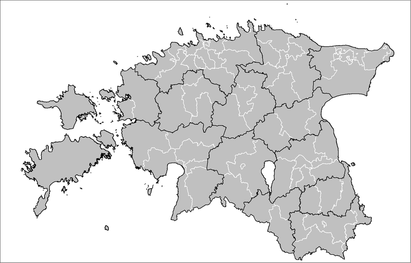
| Deskripsyon | Map of the municipalities of Estonia after the 2017 municipal reform. Created by Rarelibra 15:43, 20 December 2006 (UTC) for public domain use, using MapInfo Professional v8.5 and various mapping resources. |
| Petsa | 20 Disyembre 2006 (original upload date) |
| Gigikanan | No machine-readable source provided. Own work assumed (based on copyright claims). |
| Tagsulat | No machine-readable author provided. Rarelibra assumed (based on copyright claims). |

|
This image could be re-created using vector graphics as an SVG file. This has several advantages; see Commons:Media for cleanup for more information. If an SVG form of this image is available, please upload it and afterwards replace this template with
{{vector version available|new image name}}.
It is recommended to name the SVG file “Estonia municipalities.svg”—then the template Vector version available (or Vva) does not need the new image name parameter. |
Pagtugot
| I, the copyright holder of this work, release this work into the public domain. This applies worldwide. In some countries this may not be legally possible; if so: I grant anyone the right to use this work for any purpose, without any conditions, unless such conditions are required by law. |
Kaagi sa payl
I-klik ang petsa/oras aron makit-an ang hulagway sa payl niadtong panahona.
| Petsa/Takna | Thumbnail | Mga dimensyon | Tiggamit | Komento | |
|---|---|---|---|---|---|
| kasamtangan | 19:50, 8 Abril 2019 | | 1,601 × 1,027 (82 KB) | H2ppyme | Fixed Kohila Parish |
| 14:51, 8 Disyembre 2017 |  | 1,601 × 1,027 (72 KB) | RoMex | Updated according to the 2017 municipal reform. | |
| 07:33, 10 Marso 2017 |  | 1,601 × 1,027 (102 KB) | H2ppyme | Corrected borders of Põlva and Rakvere parishes and Võhma Town. | |
| 01:44, 4 Enero 2015 |  | 1,601 × 1,027 (122 KB) | Flying Saucer | updated Lääne-Saare Parish | |
| 23:35, 25 Oktubre 2013 |  | 1,601 × 1,027 (122 KB) | Flying Saucer | October 2013 updates | |
| 12:30, 2 Septiyembre 2010 |  | 1,601 × 1,027 (110 KB) | H2ppyme | Kaisma Parish merged with Vändra Parish | |
| 13:40, 24 Marso 2008 |  | 1,601 × 1,027 (76 KB) | Rarelibra | updated map style | |
| 17:39, 8 Enero 2007 |  | 1,281 × 878 (56 KB) | Rarelibra | Updated map of the municipalities of Estonia (due to 2006 updates). | |
| 15:43, 20 Disyembre 2006 |  | 1,281 × 878 (41 KB) | Rarelibra | Map of the municipalities of Estonia. Created by ~~~~ for public domain use, using MapInfo Professional v8.5 and various mapping resources. |
Mga paggamit sa payl
Ang mosunod nga mga panid misumpay niining payl:
Global nga paggamit sa payl
Kining ubang wiki naggamit ning maong payl:
- Paggamit sa ar.wiki.x.io
- Paggamit sa arz.wiki.x.io
- Paggamit sa ba.wiki.x.io
- Paggamit sa bn.wiki.x.io
- Paggamit sa bs.wiki.x.io
- Paggamit sa ca.wiki.x.io
- Paggamit sa cs.wiki.x.io
- Paggamit sa da.wiki.x.io
- Paggamit sa de.wiki.x.io
- Paggamit sa el.wiki.x.io
- Paggamit sa en.wiki.x.io
- Paggamit sa et.wiki.x.io
- Eesti
- Eesti külade loend
- Arutelu:Eesti
- Eesti haldusüksuste lippude loend
- Eesti haldusjaotus
- URBACT
- Eesti regionaalpoliitika
- Eesti omavalitsuste haldusreform
- Eesti haldusüksuste vappide loend
- Vikipeedia arutelu:Vikiprojekt KOV 2017
- Kasutaja:Telempe/Mall:KOV2017
- Mall:Eesti maakondade lippude kaart
- Mall:Eesti maakondade vappide kaart
- Paggamit sa fa.wiki.x.io
- Paggamit sa fiu-vro.wiki.x.io
- Paggamit sa fi.wiki.x.io
- Paggamit sa fr.wiki.x.io
- Paggamit sa hu.wiki.x.io
- Paggamit sa it.wiki.x.io
- Paggamit sa ja.wiki.x.io
- Paggamit sa ka.wiki.x.io
- Paggamit sa la.wiki.x.io
- Paggamit sa mk.wiki.x.io
- Paggamit sa my.wiki.x.io
- Paggamit sa nl.wiki.x.io
- Paggamit sa nn.wiki.x.io
- Paggamit sa no.wiki.x.io
View more global usage of this file.