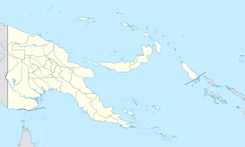
Payl:Papua New Guinea location map.svg

Size of this PNG preview of this SVG file: 800 x 481 ka mga piksel. Uban pang mga resoluyon: 320 x 192 ka mga piksel | 640 x 385 ka mga piksel | 1,024 x 615 ka mga piksel | 1,280 x 769 ka mga piksel | 2,560 x 1,538 ka mga piksel | 2,280 x 1,370 ka mga piksel.
Tibuok resolusyon (SVG nga payl, nominally 2,280 × 1,370 pixels, size sa payl: 501 KB)
Kaagi sa payl
I-klik ang petsa/oras aron makit-an ang hulagway sa payl niadtong panahona.
| Petsa/Takna | Thumbnail | Mga dimensyon | Tiggamit | Komento | |
|---|---|---|---|---|---|
| kasamtangan | 15:48, 5 Hunyo 2012 |  | 2,280 × 1,370 (501 KB) | NordNordWest | upd |
| 07:49, 26 Mayo 2011 |  | 2,280 × 1,370 (767 KB) | NordNordWest | Reverted to version as of 19:42, 8 December 2009 no need to revert | |
| 23:00, 25 Mayo 2011 |  | 2,280 × 1,370 (674 KB) | AlexR.L. | Reverted to version as of 19:51, 5 September 2008 | |
| 19:42, 8 Disyembre 2009 |  | 2,280 × 1,370 (767 KB) | NordNordWest | + rivers | |
| 19:51, 5 Septiyembre 2008 |  | 2,280 × 1,370 (674 KB) | NordNordWest | {{Information |Description= {{de|Positionskarte von Papua-Neuguinea}} Quadratische Plattkarte. Geographische Begrenzung der Karte: * N: 0.6° S * S: 12.2° S * W: 140.4° O * O: 159.7° O {{en|Location map of [[:en:Papua New Guinea |
Mga paggamit sa payl
More than 100 pages use this file. The following list shows the first 100 pages that use this file only. A full list is available.
- Alligator Point
- Bell Point
- Bird Island
- Black Rock
- Black Rocks
- Blackwater Creek
- Bo River
- Boat Rock
- Booby Rock
- Bridge Point
- Cabo de Santa Maria
- Central
- Cerot
- Coconut Point
- D’Urville Island
- Eagle Rock
- East Point
- Elizabeth Island
- Eval
- Fish Creek
- Fuma
- Goat Island
- Grant Island
- Great Harbour
- Green Island
- Guari
- Gulele
- Hagen (pagklaro)
- Halfway Rock
- Kaura Point
- Kegel
- Kor
- Krisa
- Little Harbour
- Loa
- Long Island
- Long Reef
- Loo
- Man Island
- Manare
- Manga (pagklaro)
- Merite
- Middle Reef
- Mount Misery
- Musa (pagklaro)
- North
- North Channel
- North Point
- Observation Hill
- Pigeon Island
- Pimple
- Pinnacle Rock
- Po
- Powell Island
- Puri
- Pyramid Mountain
- Rat Island
- Rat Islet
- Rock Point
- Rocky Point
- Round Hill
- Round Point
- Rugged Island
- Saddle Hill
- Saint John’s
- Sama
- Sama River
- San Antonio
- San Francisco
- San Rafael
- Sand Island
- Sanders Island
- Sandy Creek
- Sango
- Scrub Islet
- Sirius
- South Cape
- South Channel
- South Passage
- South Point
- South West Bay
- South West Point
- Split Rock
- Spring Point
- Table Mountain
- Table Point
- Tagula
- Taima
- Tari
- The Bluff
- Thompson Bay
- Three Sisters
- Twin Rocks
- Victoria
- Victoria Bay
- Victoria Point
- Wau Airport
- West Channel
- West Point
- White Point
View more links to this file.
Global nga paggamit sa payl
Kining ubang wiki naggamit ning maong payl:
- Paggamit sa af.wiki.x.io
- Paggamit sa als.wiki.x.io
- Vorlage:Positionskarte Papua-Neuguinea
- Port Moresby
- Bismarck-Archipel
- Neubritannien
- Duke-of-York-Inseln
- Admiralitäts-Inseln
- D’Entrecasteaux-Inseln
- Lavongai
- Westliche Inseln
- Feni-Inseln
- Lihir-Inseln
- Tabar-Inseln
- Tanga-Inseln
- St.-Matthias-Inseln
- Vitu-Inseln
- Neuirland
- Louisiade-Archipel
- Marshall-Bennett-Inseln
- Woodlark-Insel
- Trobriand-Inseln
- Mount Wilhelm
- Paggamit sa an.wiki.x.io
- Paggamit sa ar.wiki.x.io
- Paggamit sa ast.wiki.x.io
- Puertu Moresbi
- Nueva Bretaña
- Montes Herzog
- Archipiélagu Bismarck
- Islles del Duque de York
- Tabubil
- Islla Daru
- Estrechu de Dampier
- Islles del Almirantalgu
- Monte Lamington
- Archipiélagu de les Lluisiaes
- Aeropuertu Internacional de Jacksons
- Aeropuertu de Guasopa
- Puertu de Dreger
- Módulu:Mapa de llocalización/datos/Papúa Nueva Guinea
- Módulu:Mapa de llocalización/datos/Papúa Nueva Guinea/usu
- Islles d'Entrecasteaux
- Provincia de Nueva Bretaña Occidental
- Islles Trobriand
- Kitava
- Vakuta
View more global usage of this file.


