Payl:Troy from 4500 feet.jpg

Gidak-on ning maong paunang tan-aw: 800 x 600 ka mga piksel. Uban pang mga resoluyon: 320 x 240 ka mga piksel | 640 x 480 ka mga piksel | 1,024 x 768 ka mga piksel | 1,280 x 960 ka mga piksel | 2,272 x 1,704 ka mga piksel.
Tibuok resolusyon (2,272 × 1,704 pixels, size sa payl: 1.67 MB, MIME type: image/jpeg)
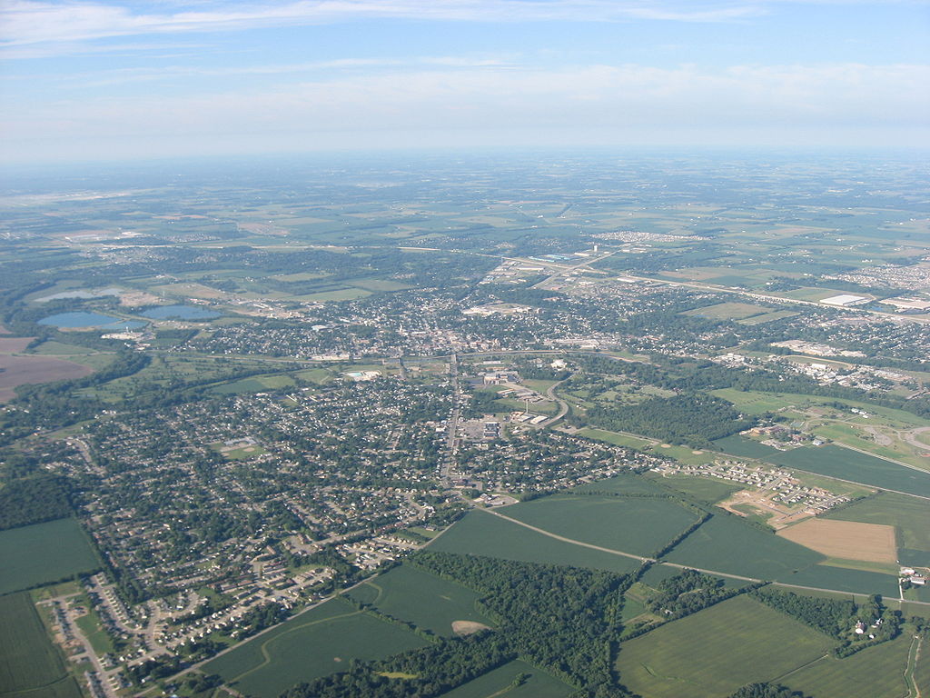
| Deskripsyon | Aerial view of Troy, a city in Miami County, Ohio, United States. The Great Miami River is partially visible in the center of the picture, dividing the city into eastern and western halves. Picture taken from a Diamond Eclipse light airplane at an altitude of 4,500 feet MSL and a bearing of approximately 215º. | ||
| Petsa | Taken on 12 Agosto 2008 | ||
| Gigikanan | Kaugalingong trabaho | ||
| Tagsulat | Nyttend | ||
| Pagtugot (Paggamit pag-usab niini nga file) |
|
Kaagi sa payl
I-klik ang petsa/oras aron makit-an ang hulagway sa payl niadtong panahona.
| Petsa/Takna | Thumbnail | Mga dimensyon | Tiggamit | Komento | |
|---|---|---|---|---|---|
| kasamtangan | 01:03, 19 Septiyembre 2008 | | 2,272 × 1,704 (1.67 MB) | Nyttend | {{Information |Description=Aerial view of {{w|Troy, Ohio|Troy}}, a city in {{w|Miami County, Ohio|Miami County}}, {{w|Ohio}}, {{w|United States}}. The {{w|Great Miami River}} is partially visible in the center of the picture, dividing the city into easte |
Mga paggamit sa payl
Ang mosunod nga mga panid misumpay niining payl:
Global nga paggamit sa payl
Kining ubang wiki naggamit ning maong payl:
- Paggamit sa azb.wiki.x.io
- Paggamit sa de.wiki.x.io
- Paggamit sa en.wiki.x.io
- Paggamit sa es.wiki.x.io
- Paggamit sa eu.wiki.x.io
- Paggamit sa fa.wiki.x.io
- Paggamit sa it.wiki.x.io
- Paggamit sa ja.wiki.x.io
- Paggamit sa ko.wiki.x.io
- Paggamit sa pl.wiki.x.io
- Paggamit sa pt.wiki.x.io
- Paggamit sa sh.wiki.x.io
- Paggamit sa sr.wiki.x.io
- Paggamit sa tr.wiki.x.io
- Paggamit sa uk.wiki.x.io
- Paggamit sa ur.wiki.x.io
- Paggamit sa uz.wiki.x.io
- Paggamit sa vi.wiki.x.io
- Paggamit sa www.wikidata.org
- Paggamit sa zh-min-nan.wiki.x.io
- Paggamit sa zh.wiki.x.io